The Vanguard Way Blog has been started to complement the Vanguard Way official website: http://www.vanguardway.org.uk/ The Vanguard Way is a 66 mile, long distance footpath between East Croydon (South London) and the South Coast port of Newhaven.
Primarily we hope to record interesting sightings along the Vanguard Way with an emphasis on flora and fauna and other 'natural' phenomena. To offer a contribution, please email vanguardwayblog@gmail.com We will be interested to receive details of what has been sighted, where and when, together with a photo if available.

Wednesday 13 April 2016

Newhaven railway footbridge now open

Don't worry about route diversions concerning the Newhaven railway footbridge, it's now open.

Copyright GCButler

 
Copyright GCButler
 
Some lovely spring weather lately - lovely day for a walk!
 
 Copyright C Saunders


Copyright C Saunders


Friday 5 February 2016

Route alterations - Newhaven Harbour railway footbridge closed


We have been notified that the footbridge used by the Vanguard Way near Newhaven Harbour station will be completely closed for around 2 months (from this week until the beginning of April).

New information, 25.03.2016
The contractor has now requested an extension to finish the work by Monday 4th April so the new Footbridge should be open on the 5th/6th April instead of the 2nd.
Please take note

The footbridge closure  necessitates quite a big diversion for those using the Vanguard Way.  Below is an annotated map of the area.  The red cross shows where the Vanguard Way is blocked.  The purple line shows the diversion.  Below the map are the altered route descriptions which will hopefully soon be signed by the local authority.


A)     Section 10

10.9    At Tide Mills turn right along paved track inland across railway and to end at car park and the A26.  Just before A26 turn left along shared use cycle/walking path some 5 metres away from A26. Follow for 200 metres and after the path bears left, another 40 metres, turn left along raised paved FP by seat and information board (faded).  After FP does sweeping left bend and just after post (Ouse Estuary Nature Reserve) turn left off paved path onto grass and follows along tree line on left to locate FP along raised bank. Follow this which bends right with warehouses on the left and a rough area over to the right. As warehouses end and path bends right, turn left down the slope by allotment sheds and over Footbridge into recreational ground. Keep along left hand edge pass metal container and out on to Norton Road by entrance to Bevan Funnell Works. Where Norton Road meets Beach Road, cross over along Transit Road and follow to the end and Newhaven Harbour Station.

Section A

A a) to e)   From Newhaven Harbour station TL at small gate before station footbridge and follow Transit Road to end and where it meets Beach Road cross over into Norton Road. Follow to the end and bear left into recreational ground just before entrance to Bevan Funnell Works. Turn right along the field and go over a footbridge over stream, pass allotment sheds and up slope onto raised bank. Turn right along path and follow until reaching open area and post (Ouse Estuary Nature Reserve). Turn right along paved FP until it joins a shared use paved track by seat and information board (faded). Turn right and follow for 240 metres along side the A26 (some 5 metres away but slightly lower) until reaching car park and paved track. Turn right along track to pass across railway at two gates and onto Tide Mills.  At cross path junction turn left to rejoin the VGW towards Seaford.    


We hope to provide further detailed information in due course and it will be incorporated into the main Vanguard Way website as soon as possible.

Our main website has now been fully updated with this information including the council notification. http://www.vanguardway.org.uk/

Reminder as of 25.03.2016
The contractor has now requested an extension to finish the work by Monday 4th April so the new Footbridge should be open on the 5th/6th April instead of the 2nd.


Monday 18 January 2016

Wet - Wet - Wet, Wet, Snow


This winter, in the British Isles, has been consistently warm, wet and windy.  An unbelievable quantity of rain has fallen resulting in a succession of serious floods in Cumbria, Lancashire, Yorkshire, South Wales, Scotland...  Here in the southeast our rainfall has been steady over the winter months and has resulted in gradual saturation making walking on country paths difficult and unpredictable.  

So far as conditions on the Vanguard Way go, any period of rain or wind will now be causing local problems of mud and flood together with fallen branches/trees.  At the far south of the route last week there were problems with flooding in Alfriston and along the Cuckmere valley.  Coupled with high tides the risk of disruption of a planned walk along the southern part of the Vanguard Way is high.  Elsewhere conditions will be challenging until there is a significant dry spell because the ground water levels are so high.

This weekend we have had a bit of a change of weather in that the unseasonable warmth has given way to much cooler temperatures and, in the case of Oxted, some snow!

We took the opportunity of doing a short loop from Oxted, over the M25 via the footbridge to the section of Vanguard Way which 'shares' the route with the North Downs Way along the foot of the Downs and across the Greenwich Meridian. (Note our shared plaque with the North Downs Way at that point).


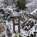
Our snow was the sticky variety and trees and bushes had been picked out with a coating of snow.  Oak trees are easy to spot with their contorted skeletons.


As we neared the M25 footbridge Oxted Downs came into view - not quite enough snow for the children to have made it over to these slopes with their toboggans this time.  Or perhaps 'health and safety' has prevailed as there were always a crop of broken collar bones and ankles from these rather 'black run' slopes.


Temperatures were close to freezing and snow was falling off trees and bushes as our walk progressed.  The going was very soft, especially on the fields along the link path where your boots were constantly needing to be tugged from the muddy grasp below the snow.  These fields are generally damp so it is expected that the situation will be worse than usual.

On the look out for wildlife footprints, we were only rewarded with small rabbit prints and dogs (or possibly foxes).

Different types of tree looked quite different with their snow cloaks - the long buds of beech, the thorns of blackthorn and the keys of ash holding onto bigger clumps of snow.  The edge of one of the cereal fields had not been harvested, possibly to provide winter food for wildlife, the 'ears of corn' looking very attractive with their snowy adornments.


At the end of the fields the Vanguard Way parts from the North Downs way and descends towards Pitchfont Farm and Titsey.  Here it appeared to be snowing but the falling snow was actually coming off the branches above as the thaw set in.


If you would like to look at individual photos again, here's the link to the Picasa Web Album:
First snow of 2016